Not so long ago, life was simpler. People talked to each other, made things, grew things. Watched the seasons. Shared a long lunch. Shared stories and laughter. In the Barossa, we still do all of these things.
When the first German and British settlers came to the Barossa in the 1840s, they knew there was something special about this broad valley, the majestic hills and the surrounding countryside. Despite the worldwide fame of its wine, the real Barossa has remained slightly hidden, mysterious even. But now everything has changed.
The widely acclaimed ‘Be Consumed’ advertising campaign, which has won awards around the world, has helped to unlock many of the Barossa’s best-kept secrets, showcasing the region’s strong farming heritage, its rich cultural traditions, abundant produce, stunning physical beauty and refreshing sense of community.
While winemaking continues to be the main activity in the Barossa – there are around 750 winegrowing families here – traditional occupations such as fruit growing, smoking meats, flour milling, cheese making, blacksmithing and barrel coopering are making a welcome return. You’ll also find a few newer products, such as virgin olive oil and craft beers, to sample during your stay.
Remaining true to its heritage, the Barossa keeps many of the old world traditions alive. But a new generation of growers, winemakers and chefs are pushing the boundaries, offering new and exciting gastronomic experiences. Whether you want a quick bite at the farmers market, a casual vineyard lunch or a fine dining experience, you’ll find it all here in the Barossa.
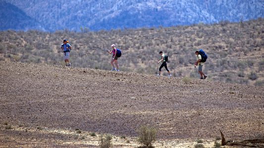
Importantly, the Barossa is not a place to be enjoyed as a passive spectator. There are so many ways to get involved – whether that’s chatting to a winemaker, cycling along the Jack Bobridge Track, visiting an art gallery, enjoying a heritage walk or taking a cooking class. And the kids will love their time here. Cycling, hot-air ballooning, skateboarding, minigolf and swimming are just some of the great things to do.
With a broad range of accommodation, plenty of organised tours, quiet country roads, picturesque villages, delicious wine, amazing food and a timeless beauty all its own, the Barossa is a little slice of heaven. We know that you’ll be consumed too.