Adelaide & Adelaide Hills
Canoeing
Canoeing

| Start Point | Garden Island Boat Ramp |
| End Point | Garden Island Boat Ramp |
| Distance | 6.0km |
| Time | 2 Hours – Canoeing |
| Download Map |
GPX |
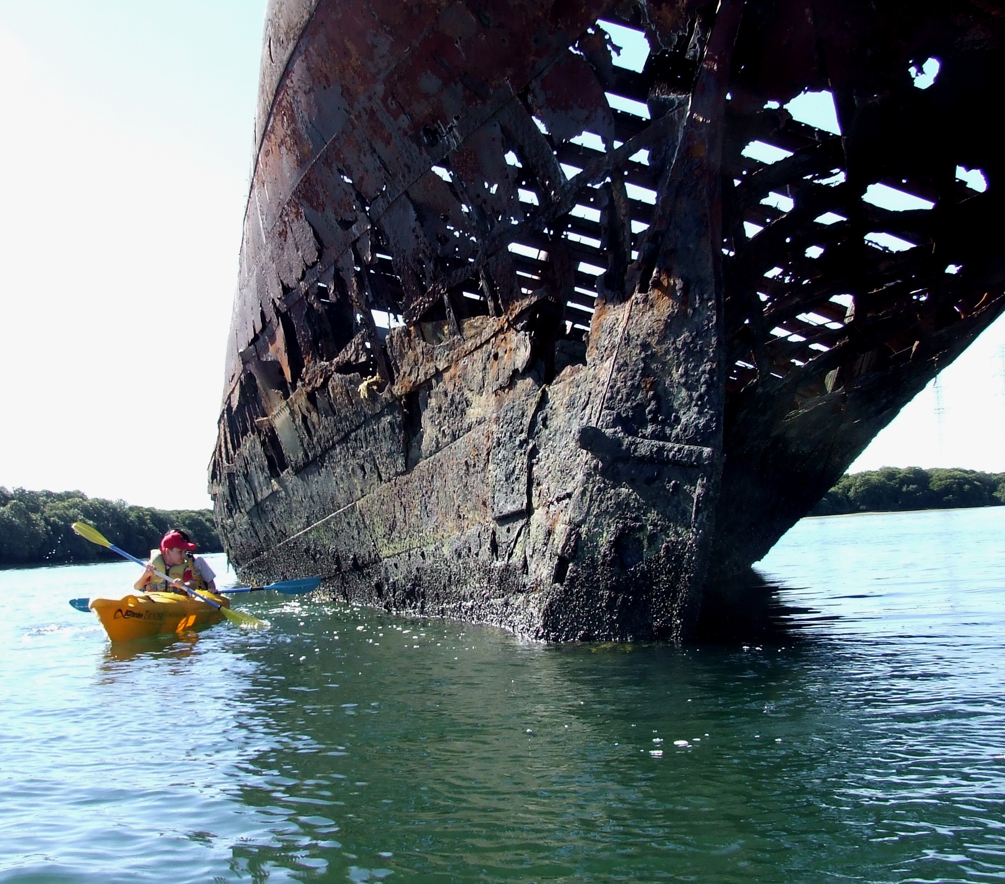
The southern shore of Garden Island in the North Arm of the Port River is one of the largest and most diverse ships’ graveyards in the world.
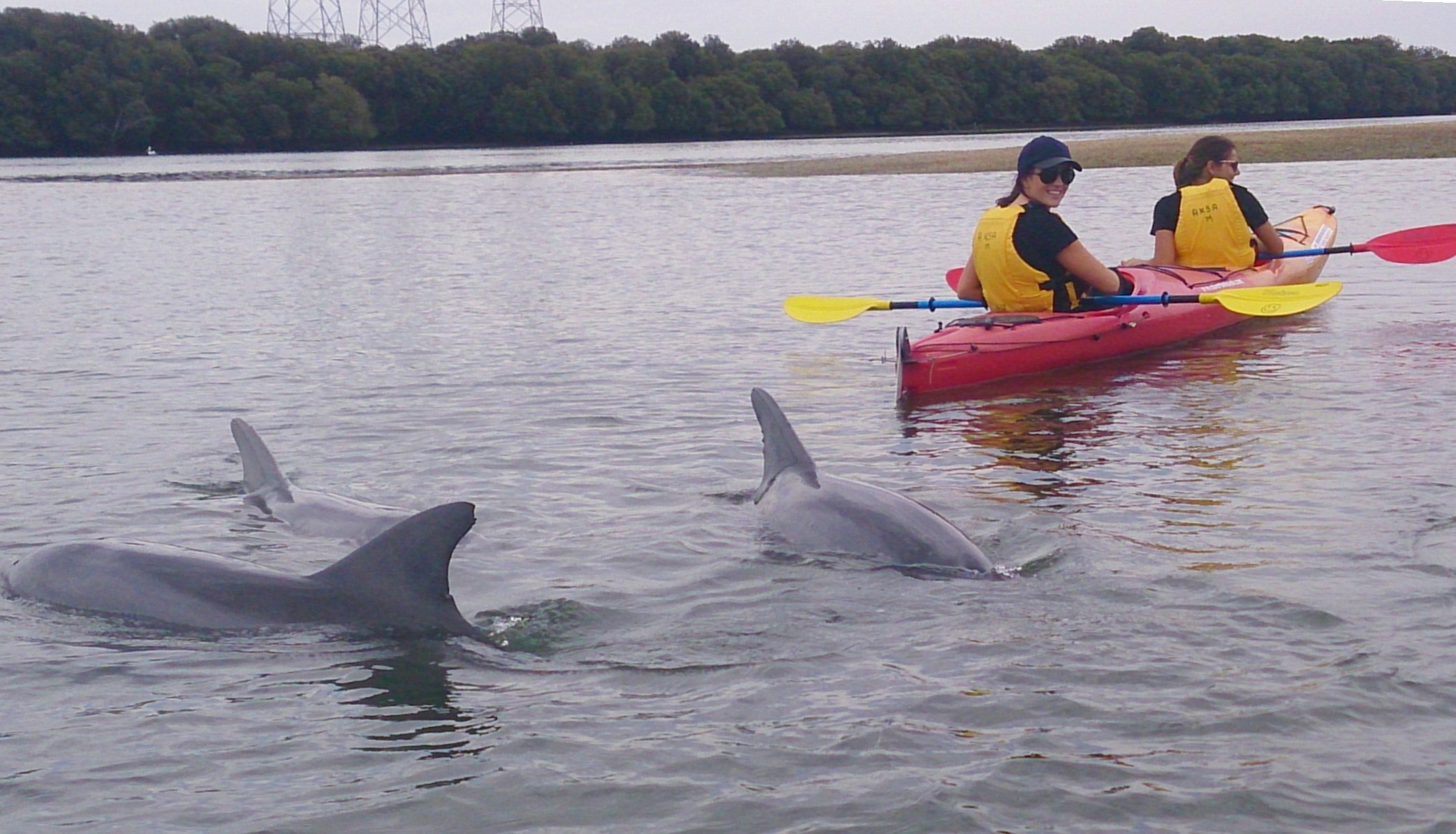
Containing vessels dating from 1856, the graveyard is a haven for birdlife and marine creatures. The ships are best seen by canoe or kayak.
Diving is also available. There is an interpretive booklet and five interpretive signs for the trail.
The Garden Island Ships’ Graveyard, in the North Arm of the Port Adelaide River, offers paddlers a chance to experience part of South Australia’s early maritime history.
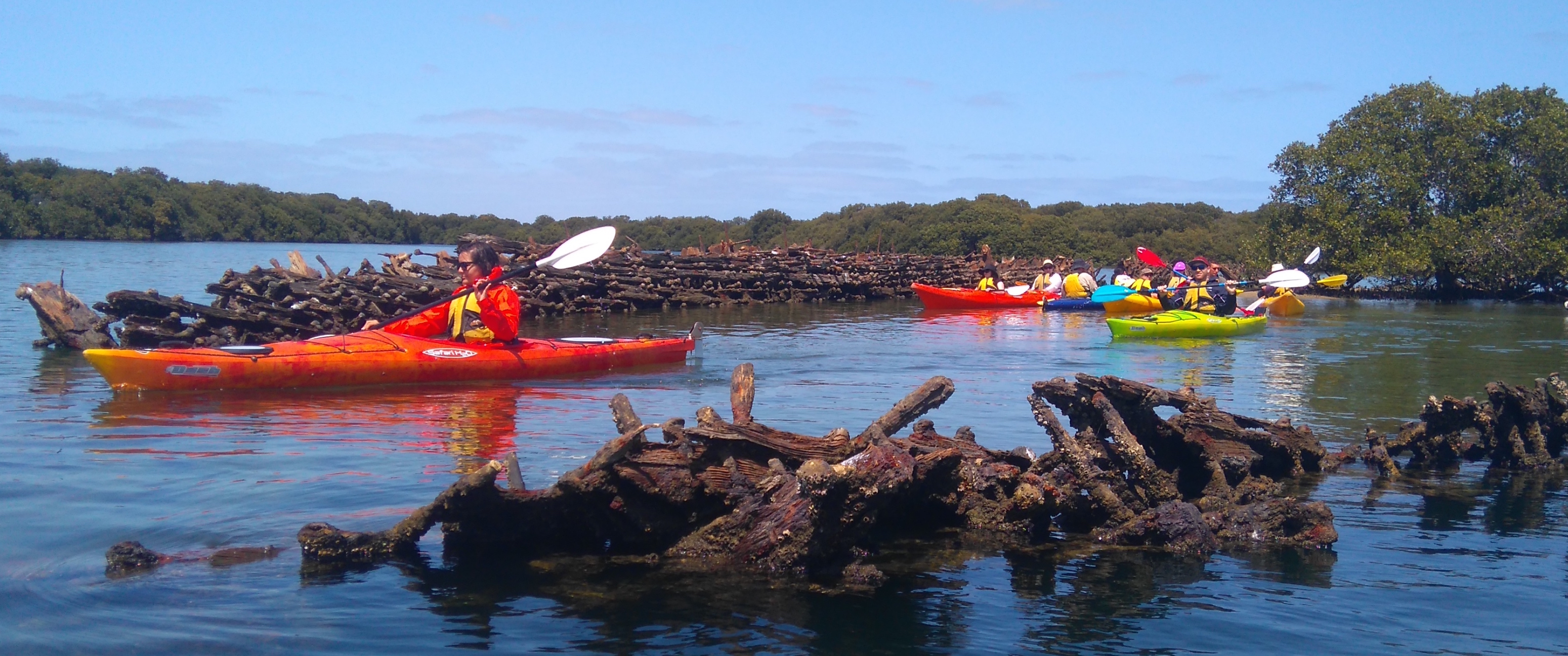
The 26 wrecks at Garden Island are part of one of the world’s largest and most diverse ships’ graveyards. Boasting the remains of sailing ships, steamers, motor vessels, ferries, barges, dredgers and pontoons, the site provides a unique glimpse into our past.
The mudflats the wrecks lay on are bounded by mangroves – one of the few remaining systems in metropolitan Adelaide. This eco-system provides a habitat for dolphins, other marine creatures and bird species, enhancing a recreational paddler’s experience.
The trail is marked by three on-water signs near the main group of wrecks, as well as two on-land signs at the Garden Island boat ramp.
Additional information is available here.
The remains of numerous ships lie in various places in Port Adelaide, with the majority in the Ships’ Graveyard in North Arm. When vessels were of no further use anything of use was stripped out before they were towed to their final resting places and abandoned. Some were broken up with explosives.
Launch from the Garden Island boat ramp and head east before turning right into North Arm. The first ship you come across is Santiago, an early iron ship. It is the oldest ship in the graveyard and the last to be abandoned there.
To the southwest is all that is left of the Dorothy H Sterling, a wooden vessel with iron keel. At low tide a sandbar is exposed to the west.
Continue westwards, taking care not to run aground on the sandbar along the northern shore. The prominent sternpost and rudder belong to Glaucus, and other vessels lie to its west. The last visible ship is Sunbeam, with Seminole submerged to its west.
In general, the lower the tide the more you will be able to see.
Spend time paddling among them before returning the way you came.
Distance: 3.1nm, 6km